Notes about this Site
Among the many assets of Michigan's upper peninsula are abundant
water and significant variation in elevation. These traits combine to provide a multitude of scenic waterfalls.
This web site is based on photos taken on trips in 1995, 1996, and 1997. It is my hope that by sharing these images
I can make more people aware of the natural beauty of Northern Michigan. If you enjoy the outdoors and are able
to visit the upper peninsula, you owe it to yourself to sample these wonderful vistas personally.
The photographs - snapshots really, all taken with a 35 mm
Olympus Stylus Zoom "point and shoot" camera on Kodacolor Gold 200 and scanned from prints - are accompanied
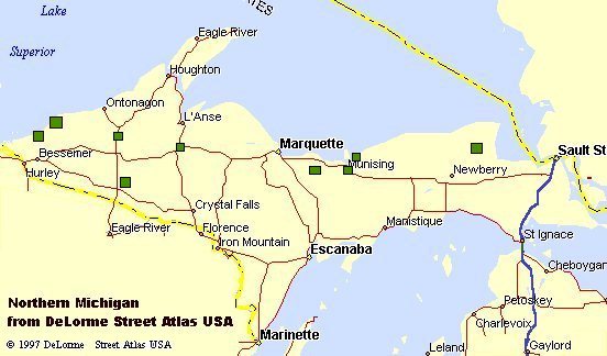
by maps copied from DeLorme Topo USA. This is to provide you with a better idea of the location of individual
falls. If you enjoy maps and trip planning, I believe that you will find DeLorme Mapping's Topo USA,
Street Atlas
USA and AAA Map'n'Go
software quite helpful.
If you plan to tour Michigan, or any of the other fifty United
States, and want to visit their natural wonders, I highly recommend that you purchase a DeLorme Atlas & Gazetteer for each state you visit. These detailed map books include virtually all public rural roads, ample
topographic detail, and a very complete list of scenic attractions, parks, historical sites, etc. These volumes
are great for planning and navigating and also make excellent souvenirs to help you relive your journeys and share
them with your friends.
To help you decide which upper peninsula falls you might want
to see during a brief trip I have included a rating system to use in conjunction with the photos.
The site was designed using both HTML tables and frames, and
benefits from Netscape Navigator 3.0 or Microsoft Explorer 3.0 or later for best viewing. Netscape Communicator
4.7 is recommended. The pages have been laid out to look best with video resolution of 800 x 600. This was
only my second attempt at web design, so constructive criticism is welcome.
Some acknowledgments are in order. In particular I want
to mention Ted Koehler of Marquette, Michigan who served as the catalyst to make these trips happen; also his wife
Ruth, for her hospitality and great company, and Kris and Jerry Marsden of Paradise, Michigan who were also wonderful
hosts during our travels. I certainly can not overlook my wife Susan for her company on these trips, and
our Golden Retrievers Sandy and Amber, whose enjoyment of
the outdoors added considerably to our own.
Please e-mail your comments to me at jnuss@twmi.rr.com. I am very
interested in your feedback about the site and any information you have about scenic falls we have yet to see.
Also, if anyone can provide translations of the Native American names of any of the falls I would greatly appreciate
it, as well as Native American names for falls now known by English names.
Finally, please be courteous to everyone you encounter on your
journeys and do everything you can to preserve the natural beauty of this planet.
John L. Nuss
Farmington Hills, Michigan
January 2, 1998
Topo USA maps and title graphic added January 24, 1999
Java menu with non-scrolling frame added February 26, 1999
Waterfalls Web Ring joined April 21, 2000
|